August 16, 2016

Day 93 - Whither Now Offy?

We have a nickname for the chart plotter: we call it Iffy. It's a name Vi thought of when it gave us a burst of temperamental fits, shutting itself down periodically at inopportune moments. Today it was more aptly named Offy. It got us here, but in the middle of trying to plot tomorrow's route into Port McNeill, it would not cooperate. I tried all manner of fixes without luck. The problem just kept getting worse, crashing sooner and sooner, until it was crashing while reading the chart data.

That seemed like a clue, but I had already reseated the smart card that has the chart data. Then I removed the chart card and powered it up and it still reported the version number of the card. Ah haa! It doesn't read the chart card at power up if the data is already stored in memory. Maybe that data was corrupted. Powering it up without the card and then re-installing the card and powering it up again forced it to re-read the chart data and the problem went away. Fixed? I don't know because I don't really understand what corrupted the data in the first place, but it seems to be working for now. I guess we'll see.

If the plotter goes down permanently, we can still use the PC (or the handheld gps) to see where we are, but it won't have radar or AIS.

We're anchored in a small shallow passage between two islands tonight. Pearce Narrows Cove is less than ten miles from Port McNeill, where we'll meet Mary Lou and Knute in the morning, spending one night in the harbor. We'll spend four nights with them, traveling south through Johnstone Straight (on a spring tide, no less) before we pop out of Seymour Narrows, around the South End of Quadra Island, and into Desolation Sound on our way to Nanaimo. It is a leg I'm looking forward to.


Day 92 - Back Around

We can't say we didn't have our choice of conditions for getting around Cape Caution. At the north end of Vancouver Island, it's the most exposed part of the trip, so the timing of it has been on my mind for several days. Hitting it at a sprint or lallygagging offers some control in the timing.

There are (for me) four things to consider: wind, wind waves (affected by the relative directions of wind and current), ocean swell, and fog. When we came north we were lucky (by sprinting) to find a window without any of the four. This time we were lucky again, but not that lucky.

Going yesterday would have dealt us an afternoon of big seas (wind waves on top of swell). Going today was much more peaceful: no wind waves, but plenty of ocean swell and fog.

The ocean swell can be kind of fun on a calm day as long as the direction isn't too objectionable. The more out of line the directions of the boat movement and the wave movement are, the more objectionable it can be. The ocean swell today was initially not substantial, but the direction of it rolled us around for a while. After we turned the corner and started down into the Queen Charlotte Strait, the swell increased to a couple of meters, but by then we were in line with it so it wasn't so bad.

While the ride was more comfortable than it would have been yesterday, the visibility was worse. We were in thick fog and blind for most of the day, had to rely on our electronics to see for us. The radar and the AIS system got a good workout. AIS is an identification system that commercial traffic is equipped with. It transmits position, speed, course and boat data, much like airplane transponders do. It's pretty essential equipment for dodging fishing boats and tugs with barges.

As is the case with most recreational boats, Quijote doesn't transmit AIS (yet,) but it does receive the data and displays the traffic on the chart plotter. That allows us to see the position of most of the important traffic - the boats that are large or fast, but not most of the other recreational traffic. To see the non-AIS equipped vessels requires radar.

I did some experimenting with different display modes today, overlaying the radar image onto the chart image, then displaying the radar image and the chart image side by side. I found the modes useful in different circumstances. Overlaying works well in cases where boats and small islands can be confused. Separate windows was useful for cases where one might want the navigation to be done at one chart range while the radar is set to a wider range to cover more area. Cool stuff.

I find that some boats, especially fiberglass motor-cruisers are difficult to see on radar, because they don't have a lot of reflective metal well off the water. Seeing poor targets in less than 100 yards of visibility requires vigilance of two kinds: one person seeing through the fog and one person seeing a flickering blip on the radar that comes and goes amid the clutter of wave reflections.

While that might sound a little dubious, even risky, it's not as bad as it sounds because no boater in their right mind would be plowing through that fog without radar and Quijote has an excellent target signature. High on the mast is a good quality radar reflector, so even when I can't see them very well, they can see us. If they're paying attention.

Day 91 - To Go or Not to Go

As much as it might have sounded yesterday like the decision was made on whether or not to get around Cape Caution, Kay and I went back and forth about it for as long as all options were still on the table. We even added an intermediate option to stop at Walker Island Cove to get us around the cape but enjoy a shorter day. We were constantly updating our thinking as conditions and forecasts evolved.

The shorter day to Millbrook Cove on this side of the cape would be 25 miles. Continuing on around the cape to Blunden Harbor would add about 30 more. In the end Kay asked me to decide and I went with the shorter day. The Pine and Egg Island lighthouses were reporting zero vis and fog. The forecast was calling for the wind to pick up this afternoon and then settle down tonight, which should make for easier seas when we get up early to go around tomorrow morning. Listening to the wind generator humming away up on deck, I think we made the right decision. We probably would have been fine going today, but why not do it in more comfortable conditions?

Day 90 - The Strait of Quijote

Civilization is encroaching. We haven't even rounded Cape Caution yet and already we're starting to see a lot more boats. Today we were caught up in what seemed like a flotilla streaming into Fish Egg Inlet. Thankfully the inlet is vast with several anchorages to absorb them all. Even so, there were three other boats in our little cove.

We decided on Green Island Anchorage at the entrance to Fish Egg Inlet for its proximity to Fitz Hugh Sound just outside the entrance to the cove. The other coves inside the inlet are several miles in. Positioning ourselves near the entrance was intended to give us the option of leaving as early as possible in case getting out and around Cape Caution quickly seemed prudent.

As it turns out, the rounding will probably go better on Sunday, so tomorrow will be a light mileage day. There's nothing wrong with that I say. I can do without the drizzle that's in the forecast, but at least we won't have gales to wait out.

We motored south today under wispy high clouds - mackerel skies and mares tails (make sailors shorten sails). Our fair weather will be leaving us. It was glorious while it lasted. Thankfully the front that is moving toward us will be dissipated by the Queen Charlotte Islands.

The Queen plays a big roll in this neighborhood. The Islands are about 50-100 miles off the central coast of BC. The crossing by ferry can be so rough that they anchor vehicle axels to the deck. The Islands also go by their native name: Haida Gwaii. South of there in the neighborhood of Cape Caution is Queen Charlotte Sound. From there, the passage between Vancouver Island and the mainland is called Queen Charlotte Straight. You'd think they could have come up with another couple names in that mix. It would have made it a lot less confusing. Heck, Haida Gwaii already had a name, so they only needed to come up with one. They should have asked me. I'm sure I could have come up with something. The Strait of Quijote?

August 11, 2016

Day 89 - Fire and ice

We're in Shearwater tonight. The water tanks are filling while we drink gin and tonics. In real ice! Ahh!

What a terrific weather day it was today: hot and sunny; just like it was the last time we were here. Word has it the weather is not always like this. A week ago, they say, a big electrical storm hit and knocked out electricity thoughout the entire town. And they say July was a brutal month for rain. Sitting here, cold drink in hand on such a hot day, it's hard to picture it. I will always remember Shearwater as the sunniest, hottest marina on the inside passage.

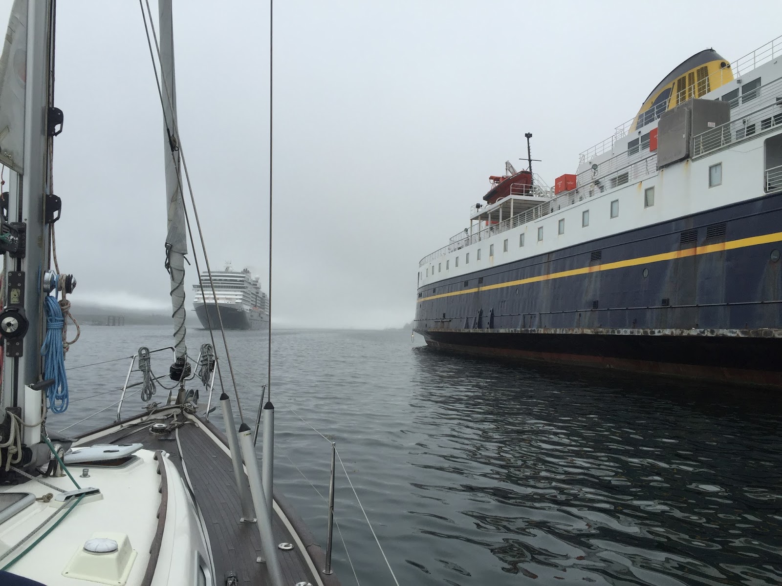
We left Boat Cove this morning at high tide and were tied up by 11:30 or so. Boat Cove was one of the smaller coves we've anchored in: a tiny little land locked cove that has just enough swinging room for two or three boats and sits inside a short, shallow, narrow entrance. The entrance has just two feet of depth at zero tide, so we had to come and go while the tide was high. Add ten feet of tide to that two feet of depth and we had just a few feet to spare when we left this morning.

The memorable thing about Boat Cove though wasn't that it was small, cozy, quiet and beautiful. We can say that about most of the anchorages along the way. The memorable thing about it was the crab that we scored while we were there. We arrived last night, after winding our way through Percival Narrows, to find a motor-cruiser in "our" cove. what was worse, they had crab pots out that took up half the cove. Hurrumph! Those crab pots turned out to be pretty sweet in the long run.

While Wendy and I were out for a dinghy row around the cove, checking out the nooks and crannies, the couple on the cruiser, "Remote Access," (their tender is called "Local Access") called out to ask if we wanted some crab. They were from Anacortes and were so friendly. It was really nice to meet them. We chatted for a while and they gave a large bag of crab. It was even cooked. Way cool. They had more than they could eat they said. I guess it really pays to put those pots out. We have one, but we don't catch fish and so don't have much in the way of bait. They use the heads off the fish they catch and mix it with cat food, the story goes.

One of the things I'd like to improve about this whole experience is my ability to take advantage of the bounty that inhabits the waters around the boat. It would be a lot easier on a bigger boat. I have to choose carefully what we make room for on a 37' boat and so far fishing gear has not been high on the list. Some day I'll make it happen. I have to learn to make it work first. Once I know what I'm doing I'll have confidence that the space I'm taking up for it is space well spent.

We put that crab to good use. Jerry spent the better part of half an hour cleaning the meat from the shell. Then tonight while sitting at the dock in Shearwater Kay, with Wendy's help, made crab cakes from a recipe Kay brought, imagining that we would catch crab at some point on this trip. Those were some awesome crab cakes: moist, fresh and flavorful.

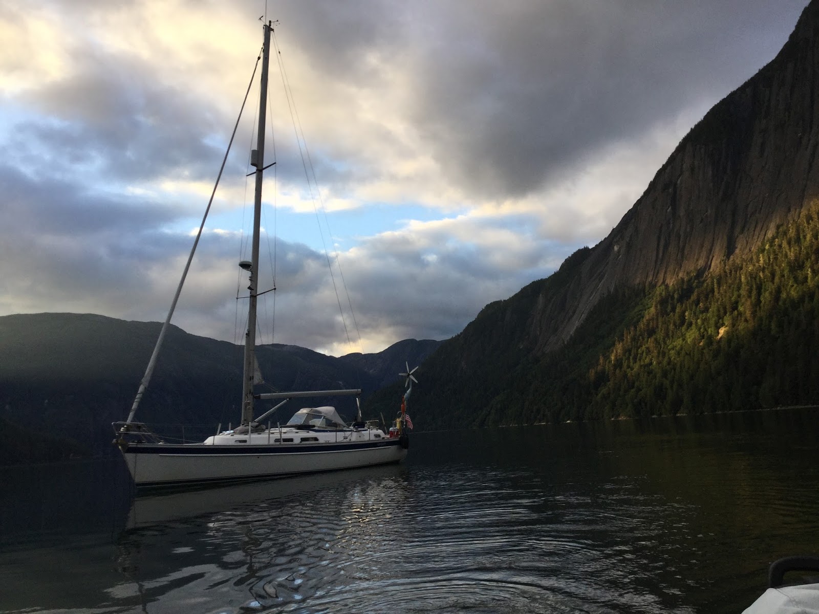
The bay we anchored in the night before last, around the east end of Roderick Island, was called Windy Bay. It was the antithesis of Boat Cove. The bay was large, deep and easy to get into. In fact, it was so large and so deep, that it had difficulties of another kind: instead of being difficult to get into, it was difficult to anchor in. The ideal depth for anchoring is thirty to seventy feet. Much less than thirty feet and you run the risk of running aground at low tide. Much more than 70 feet needs too much anchor chain to give you good scope. Windy Bay stays deep and then gets to the right depth close to shore. There was one spot that was easiest to anchor in, but someone had already parked their boat there, so we were forced to find another spot that was less optimal. We ended up in seventy feet of water with three to one scope: 210 feet of chain. Three to one is fine if you don't expect to get blown around much. As it turned out, the bay was calm for the night.

The advantage of such a big, wide bay, didn't present itself until the following morning. I was up on deck, enjoying the stillness of the morning with a mug of hot chocolate and listening to the gulls singing their morning songs, when I heard the distinctive sound of whales breathing. I didn't see anything right away though. We were so used to seeing the humpbacks blowing mist when they breathe. It turns out these were orcas. The pod took a spin through the bay and went out through a small passage at the entrance.

Now we're in Shearwater. The tanks are full, the laundry is done, dinner is eaten and showers taken. We ended up doing the hike to Eddy Lake that Bob did on the day he departed. As I think he noted at that time, it is a bit of a mud slog. With the day hot and sweaty, it was so so nice to go swimming when we got there.

Tomorrow Wendy and Jerry will be leaving us to fly home and we will be sorry to see them go. They have been excellent crew: eager to contribute and great company. After seeing them off, Kay and I will continue south retracing our steps through Gunboat Passage and into Fitz Hugh Sound toward Cape Caution and Port McNeill where we'll meet Knute and Mary Lou. What fun!


Day 87 - Cheers

Wendy and Jerry whipped up an Indian(ish) meal for dinner tonight consisting of curry, tofu, cuscus, rice and other assorted tidbits. Was that cocoanut and sweet potatoes in there? Yum! They also served a curry ginger cabbage salad that was excellent, and artisan bread dipped in balsamic vinegar and Salim's awesome home pressed olive oil.

Three cheers for the cooks! Three cheers for Salim!


Day 86 - What's up doc?

Tomorrow morning we'll weigh anchor, slip through Thistle Passage, and make the return trip through Meyers Narrows. We'll have to navigate the narrows at low water slack, so we'll see depths of 20' or less. High water slack would mean a six hour wait and I'd rather have no current than more depth. All it takes is 6.5 feet. After popping out on the other side of Meyers Narrows, we'll start a two day circumnavigation of Roderick Island. What a great name for an island!

So… From Prince Rupert, we spent nights at Captain Cove, Ire Inlet, Curlew Bay, Hague Point Lagoon and Alston Cove. Then it'll be Windy Cove, Boat Cove, and Shearwater - eight nights in paradise on this segment, each one better than the next. Or so it seems sometimes, but that may have more to do with a dubious memory than with the quality of the anchorages. I can say that the bugs have been behaving themselves and we haven't seen more than one other boat in any anchorage this segment. I anticipate that the further south we get the more competition we will see for the anchorages.


Day 85 - Room with a View

Hague Point Lagoon is one of two anchorages that had me feeling a little nervous when I picked them. Like Ire Inlet a couple of nights ago, the description of it was that it is very narrow and poorly charted. Great. Further, while Ire had ample depth, the entrance to Hague is a fathom at low tide. That's less than the boat draws, so timing is key. The other thing that gives me pause for both anchorages is that I never really know what to expect for current. My strategy was to hit it at high water and have faith that the current (and depth) will be reasonable.

As ever, the unknown was a larger demon than the deed itself. There was plenty of depth and very little current. But it was narrow. There's a short dogleg around a couple of charted obstructions in the narrowest part, so slack water gave us the luxury of going slowly around them.

Once in, we found ourselves in a circular little cove with easy anchoring and room for several boats. Kay whipped up an awesome halibut chowder for dinner and then the four of us rowed the dinghy to shore for a walk. There wasn't much in the way of shoreline, but the chart showed a lake nearby. We found the drainage into the cove and followed it through a mossy cedar forest to the primeval looking lake. There was no accessible shoreline on the lake either, but it was beautiful. I have little doubt that the lake and this cove look the same as they did ten thousand years ago. Untouched. OK one touch: a small path has begun to form where boaters like us have crawled through the brush in search of the lake. Everybody likes a little exercise and a view.


Day 84 - What's in a Name

Lunch is in the works as I consider what to write about this anchorage. A lot of nicknames could serve for Curlew Bay. Ravens Roost? Fly Basin? Mamba Midden? Humpback Hideaway?

There is a colony of ravens perched in the trees overlooking the boat that make the most bizarre sounds. They cluck, hoot, whistle and honk at irregular intervals. Even flying, their large wing spans make a louder whooshing sound than most birds I've heard. Quiet these birds are not, but they are entertaining.

The sun is out and so are the flies. We probably shouldn't call this anchorage Fly Basin though because another already exists. We anchored in the official Fly Basin after rounding Cape Caution on our way north. Oddly enough there were no flies in Fly Basin. In these conditions though, I'll bet any anchorage could be counted on for a few flies. We've primarily seen deer flies on this trip. They don't bite unless you ignore them. They also don't die. They have an innate sense of danger that allows them to ignore feints, but disappear at the first hint of real intent. Moreover if you do succeed in striking one, no casual blow will do. You can leave it's guts smeared on the deck and it will still fly away, laughing at you for the mess you have to clean up. That's a fly with an impressive degree of evolutionary complexity.

The name Mamba Midden is a nod to the cruise ships that have sailed by on their way up toward Grenville Channel the last time we anchored here. I was working on something below deck and and I thought I heard music. That's a curious sensation in an anchorage that feels so remote. I couldn't imagine where it would be coming from. Poking my head through the hatch and looking up into the channel I saw what appeared to be a city block floating by the bay entrance. The passengers on the upper deck of that floating fourteen story building sounded like they were having a grand old time.

Then there are the possibilities such as Whale Outlook, Humpback Hideaway, or Breach Bay. We threaded our way out of Ala Passage in the dark today, our second pre-dawn start of the trip, then passed through Principe and Otter Channels, and up through Lewis Passage before turning into Curlew Bay. We saw whales blowing, sounding, and breaching just about the whole way. Their numbers seem to have increased throughout the summer. It would be interesting to know if they are just more active or if we are more in tune with their presence and just notice them more readily. The last time we passed through here, we didn't see any in this area. This time we can even see and hear them out in the channel from our anchorage.

There are so many great names to choose from. Then again, with a halibut taco now in hand, maybe I'll just call it Leftover Lunch Lagoon.

Day 83 - High Water Waiting

We tried to time our arrival into Ire Inlet on Anger Island for high water slack at around 4pm, but we made better progress than expected and needed to kill some time before entering. We cut the engine and drifted for an hour while we ate lunch. It was tough duty on a windy summer day in the sunshine with wild coastline all around. Kay and Wendy put together a delicious spinach salad with tuna salad on crackers. We drifted along at two knots in a stiff, steady breeze, without the benefit of sails.

The further we get from Prince Rupert, the more remote it feels. There are no longer any signs of human presence and we only saw one other vessel all day. We passed Sine, Cosine and Tangent Islands, so named by surveyors who found the islands difficult to record without trigonometric conveniences.

The entrance into the inlet was about as narrow as we've seen on this trip, with rocks on one side and fallen trees encroaching on the other. Threading our way through, we were glad for the high tide.

There's a sidebar in our guidebook by Douglass detailing the misfortune of one sailboat that got their rigging wrapped up in one of the trees on the way in and were forced to extricate themselves with saws, doing considerable damage to the boat in the process. Thankfully we avoided such pitfalls, but we did see the results of their labors fifteen years later.

Tomorrow we'll make our way out the way we came in. Getting out at high tide again will mean a 5am start. Up at 4:50 and out at 5:00; there'll be no waiting around for it.

Day 82 - Snubbed

We're in Captain Cove tonight, an anchorage we blew by on our way north. Today we're covering ground at a more leisurely pace. We're on our first day out with Wendy and Jerry after saying sad farewells to Tina, Sue and Tom.

After a late start, we enjoyed a sunny, windy day. The winds were even blowing in the right direction. We hoisted sails and flew south from Prince Rupert, out of Chatham Sound, and through Arthur Passage into our own slice of tranquility.

If I had to coin a nickname for this cove, I'd call it Hummingbird Bay. Shortly after arriving, we ran through our anchoring and snubbing procedure with Wendy and Jerry. We set our anchor with a four to one scope, then rigged a snubber to take the strain off the the windlass and to dampen the chain noise if it drags back and forth on the sea bottom.

With the snubber set, we were standing on the foredeck chatting, when a hummingbird swooped in, probably attracted by my bright red jacket. It hovered a foot from my face and we stared at each other eye to eye for a moment. He was clearly wondering what kind of huge red flower I could be and I was wondering if I was about to lose an eye to that long, needle sharp beak. Finally the spell was broken with his deciding I didn't smell as good as I looked. We moved on, each attending to our need for sustenance.

August 3, 2016

Day 80 - Crew Overlap; Rod

We're in Prince Rupert for a couple of nights on our way south, refilling tanks, and exchanging crew.  After a great nine day leg from Petersburg, through Ketchikan, and around the Misty Fjords, Tom, Sue, and Tina will be flying home tomorrow.  Wendy and Jerry will be with us now until we reach Shearwater.  I always enjoy the crew overlap; it's a day of chaos getting everything done, meeting up with the new and saying our fond farewells to the outgoing folks.  It's fun to have a dinner meal in town together with incoming and outgoing crew as it is usually a time filled with stories and a lot of laughs as we relive the previous couple of weeks and regale the new crew with things to look forward to.

One of the things that I've been doing on this trip is asking crew members to contribute two dinner meals a week per person.  I've asked that each of us provision, and take charge of those two meals for each week that we're on board.  I think most of the crew that have participated in this trip so far will tell you that it is a request that has been satisfied with no small amount of anxiety.  Most of that anxiety is, I suspect, a fear of the unknown.  How will it go, preparing a dinner meal for a crew of strange people on a small sail boat?  What if I crash and burn?  The anxiety created by this seemingly small request is not dampened by outgoing crews who wax eloquent about the truly amazing meals created on the previous leg.  As understandable as these concerns may be, I have to say the meals that have been enjoyed on our little voyage have been uniformly exceptional.  Everyone has put a lot of thought and preparation into what they want to do; the creative juices have flowed, and the meals have been awesome.  I'm so glad it has worked out so well and I so appreciate the effort that has gone into such good eating.  Eating well is, I think, one of the primary pleasures of (cruising) life.

Overlapping crew has created some sleeping challenges as well.  We have seven overlapping crew tonight.  When we were in Wrangell, we had eight crew for one night of overlap.  In that case, Frederic graciously volunteered to sleep on seat cushions laid end to end on the floor.  Tonight we're making use of a hotel room.  Thankfully everyone has been flexible and maintained a spirit of doing what it takes to make things happen.  Thanks guys!

I'll wrap this post up with a few of the many photos that Sue sent me.  She took them over the last week and a half; including Petersburg, Ketchikan, Prince Rupert and the Misty Fjords.  At some point I think we'll try to put a Drop Box together that will give us a place to share our best images of the voyage up the Inside Passage to Glacier Bay on SV Quijote.


Petersburg


Ketchikan


Green Island


Prince Rupert

Misty Fjords

Day n - A mathless look at tides and currents; Rod

If you ever find yourself asking how something works or why something behaves as it does, there's a good chance you are, or could have been, a scientist of some kind. I have an academic background in physics, so I have a fondness for observing oscillations in natural phenomena. When I can't understand something physical it becomes food for thought.

Such was the case when observing that the predicted time for slack current though the Chatham Narrows was two hours after low tide. That's the kind of thing that sits in my brain and bugs me. Oscillations generally come to rest at the highest and lowest points, like springs or pendulums do. Yet here is a current that continues to flow for two hours after low tide. How is that possible?

The introductory material to most reading on the subject of tides in the area will tell you that there is a lot of river outflow that reduces the predictability of tides, but that explanation doesn't satisfy me. Two hours feels like too much to be explained by river outflow.

Lying in bed on the morning we were to leave for the narrows, I had an epiphany: Imagine we have a current station at each end of the narrows and we can generate tide charts for each station (Figure 1). If the water flow supplying each end is different, then high and low tide will arrive at different times. When the tide is higher at one end than it is at the other, current will flow. When the two tides are equal, we have slack.

In Figure 2 we see the green areas where the tide is higher at station B than it is at station A - current flows from B to A; and the orange areas where where the tide is higher at station A than it is at B - current flows from A to B. Where the lines cross, the tides are equal and the current is slack.

If you look at the timing of these events though, the time from high tide to low tide is roughly six hours, so high tide to slack is less than an hour. Something else is at work that explains how the time from high tide to slack can be two hours.

Then it occurred to me that better flow to one station and diminished flow to the other can mean more than a difference in timing of the tides; it can also mean higher or lower tidal swings. Figure 3 shows what happens when one station has smaller tidal swings than the other. The effect is to increase the currents and delay the onset of slack. With that we finally see slack current that has been delayed by about two hours.

As the Greeks would say: Quad Erat Demonstrandum (QED); and all without math, which should leave Tom feeling a little unsatisfied.


Day 79 - Miles to go; Rod

We enjoyed a great hike in Punchbowl Cove today. It was advertised as a muddy scramble to a lake and it was definitely all of that with a slippery, moss covered boardwalk thrown in for good measure. The payoff, aside from the heart pumping exercise and the beautiful trail through lush, mossy forest, was a gorgeous freshwater lake beneath towering cliffs. The trail was reported to have a lot of bear activity, so it was fun to think of creative ways to make a lot of noise while hiking. Thankfully we saw plenty of scat, but no bears. With all the noise we were making there was probably not a bear within ten country miles.

Returning to the boat, we pulled up the anchor and headed around the corner from the cove to see a bird rookery and check out a scramble route to a ridge that our buddy John H told us about.

The rookery turned out to be a verdant cliff towering over the the water, covered in moss and shrubbery, and dotted with nesting sea birds. It was an active, cacophonous community. We drifted below the maelstrom for a short time and imagined what it would be like to live among them, perched in a small indentation in the cliff face, looking out over the sea and protecting our young.

The scramble route around the corner to the rookery looked inviting. With another day to tarry, we'd have loved to find our way to the top. As it was, we were compelled to make our way out of the inlet and get going to the next anchorage. We have flights to keep and miles to go before we sleep.


Photos above by Rod; Photo below by Sue


Day 78 - Breakfast on Quijote; Rod

Morning is a favorite time; it's calm, peaceful, introspective. Sea birds pass by; the tips of their wings tap the glassy surface of the water leaving a line of expanding rings. Cloud puffs traverse the forested hillsides along the passages. Bright silver threads of sunlight wander through the overcast as the morning matures. We're surrounded by rippled reflections of hills and sky. A crisp morning breeze created by our motion caresses our skin and chills the fingers, compelling us to zip up jackets and put hands in pockets. The smooth hum of the engine pushes us onward as the dinghy rustling and slapping, endeavors to keep up.

Tina digs fruit out of the cooler for breakfast. Kay studies the day's chart leading to Punchbowl Cove in Misty Fjords National Monument. Sue, Tom and I watch the water ahead for hazards, warming our hands on tea mugs. The crew is quiet and reflective.

Breakfasts on board Quijote are occasionally elaborate - eggs, or pancakes - but for the most part they are simple, consisting of oats, cream of wheat, or Kay's home made granola. We pile on a lot of fruit, usually some combination of apples, peaches, or berries. We'll add raisins or dried cranberries, sprinkle on walnuts, pecans, or pumpkin seeds. Some of us will sweeten the concoction with brown sugar, honey, or maple syrup and top it all off with a large dollop of creamy Greek yogurt. Mingled with taste buds on a pristine morning in Southeast Alaska and it's a perfect way to start the day.


Photos by Sue

Day 77 - When is a trail not a trail? ; Rod

The first of two anchorages in Yes Bay were occupied by a junk barge full of derelict motor boats and a motor-cruiser from Anacortes, so we made our way deeper into the bay and found the seclusion and pristine scenery we sought near the head.

While Sue made up a curry, veggie, tofu masterpiece for dinner, Tina and I headed out in the dinghy to find a trail reported to be in the bay by the US Forest Service. We found pink flagging where we expected the trail to be, and even a light trail of sorts, but it was so log strewn, overgrown and muddy as to be all but impassable. That's saying rather a lot coming from this quarter. Trail or not a trail?

Yes Bay


Photos by Rod

Day 75 - Winds Made Good; Rod

Finally a day of wind and weather suitable for sailing. We left Ketchikan this morning at a reasonable hour and headed up Behm Canal for the first day of our circumnavigation of Revillagigedo Island. The clouds over Ketchikan were so low that the constant stream of float planes entering and exiting the city were practically skimming over the water to maintain (sort of) visual flight rules.

As we proceeded further from town, the clouds began to lift until we found ourselves winding through the small islands of Clover Passage under partly cloudy skies and occasional sun breaks. From there the day only got better.

The thing about winds that turn to follow and build to something worthy of sailing in is that they sneak up on you unnoticed. The winds hide themselves in the boat speed. It had been so long since we've seen good sailing weather that I almost didn't recognize the sunshine, let alone the following wind. Finally Tina noticed it and wondered out loud if we should be sailing. Damn straight! We shook out the sails and cut the engine. What fun! What a relief to be making way without the engine. The sailing and sunshine lasted most of the afternoon - definitely a good day.

Tofu Curry by Sue


Chicken Tacos by Tom


Photos above by Rod; Photos below by Tina


July 27, 2016

Day 74 - Southeast Alaskan Balderdashery; Rod

Wet, wet, wet. Windy and wet. Wind in the wrong direction, soggy, and wet. As much as it grieves me to report less than ideal conditions, today's primary silver lining was in the safe and successful voyage from one anchorage to the next. Alas, that is hardly anything to gush about.

Sure - the anchorage is beautiful. It's scenic, remote and we have it to ourselves. During the day the forest covered hills were shrouded in ancient, primeval looking misty tendrils of low clouds and fog. As we slid along the coast of Prince of Wales Island, purse seiners and fishing trawlers occasionally emerged out of the mist like ghosts from the past telling stories of hardscrabble lives at sea.

But as breathtaking as today was, it was a beauty we have come to expect. We're like wizened veterans of life in a remote cottage perched above the sea, hardly noticing the grandeur that abounds.

OK, I'll admit, that was a suit I was trying on more for the curiosity of fit than for the style. And I'll confess it feels a little tight under the arms. I guess we'll stay a little longer and see where tomorrow's fashion takes us.

If all goes according to plan, tomorrow we'll head in to Ketchikan for hot showers, a nice restaurant, blog uploads and full tanks.  In the words of Timbuck Three: "The future's so bright we gotta wear shades." And foulies.


Day 73 - A Whale of an Ovation; Rod

The boat is abuzz with animated discussion of the days whale watching activity. Arriving at the anchorage late in the day at high water slack, we were greeted by a pod of wales blowing and breaching - not a bad start for our new crew. One energetic whale with a flare for showing off obliged his gaping audience by throwing himself into the air in a rotating half-gainer a mere fifty yards from the boat. Bravo!

We started the day with a southbound transit of the Wrangell Narrows. While I steered the boat through a maze of navigation aids, Tom glassed the buoy numbers and Sue recorded them in a log and followed our progress on the paper chart. We timed our passage more for our arrival at tonight's bay than for the direction of the current through the narrows, so we were headed against it for most of the day. We were bucking three knots at one point.

On arrival at the anchorage, Sue went straight to work cooking thick slabs of fresh halibut on the barbecue. Encore!

July 25, 2016

Day 72 - Fishy Business; Rod

Quijote is once again rocking with new crew. Tom, Tina, Sue, Kay and I are hard at work, provisioning for the coming leg and getting reacquainted with life on the boat. We leave tomorrow for a nine day segment that includes a one night stop in Ketchikan and several days to circumnavigate Revillagigedo Island through the so called Misty Fjords.

One treat that we've (re)discovered in our time here in Petersburg is the availability of fresh seafood. Petersburg doesn't cater to tourists as much as some of the places we've stopped, especially the places where the cruise ships stop. That makes it nicer to explore and makes us stand out as the fresh off the boat tourists that we are.

Before leaving for the break we noticed a small business in town that sells, packages, and ships flash frozen seafood. We also ate at a small restaurant with picnic tables out front that specialized in king salmon, rockfish, and prawns. Now that we're back in town, we're taking advantage of both establishments: We had dinner at the restaurant last night; Tom bought king salmon for the barbie tonight; Sue will do halibut tomorrow night, and Tina will make a curry prawn dish the following night night. Awesome crew!

It rained most of the day today, so it was a good day to take care of stuff around town. Tomorrow, with the weather predicted to improve, we'll start heading south and anchor in Red Bay; an anchorage that recommends slack water and high tide to get in and out of, so we'll be leaving town at a leisurely hour tomorrow.

The crew is eager to get going though, so with luck I won't have to tie anyone to the mast to settle them down before we get under way.

Apologies for the paucity of photos - I get many requests for more photos, and we’ve taken a few, but there is honestly not many options for getting them up onto the cloud.  Ketchikan has a big Safeway with reasonable wifi, so I’m hoping we’ll get a chance to upload a few when we arrive there in a few days.