June 28, 2016

Day 43 - Bergie Bits; Rod

I just discovered this post failed to upload because of too many photos, so it will appear out of sequence.

We jousted with icebergs today.  We left Snug Harbor at 5am to make it to the Tracy Arm bar at an early slack and started seeing icebergs well before Tracy Arm.  A lone berg was rolling along out in Stephens Passage with a dozen birds perched on top.  There was also a cluster of bergs grounded on the bar, but thankfully none that impeded our progress into Tracy Arm.

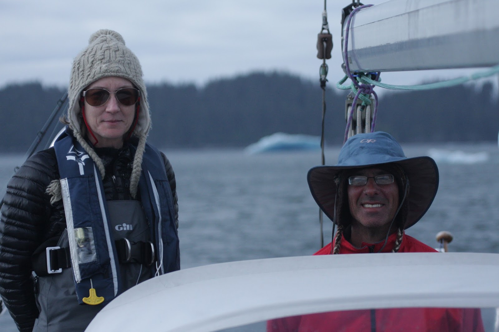
The first several miles of the arm were dotted with occasional icebergs and the wind was wandering along with us.  The further we proceeded, the stronger the winds got (making me want to put the sails up), and the more closely packed the icebergs became (making me want to leave them furled).  At times the bergs were so closely spaced that we were forced to reduce our speed to a crawl to avoid hitting them.  They ranged in size from typewriters to city blocks.  Some were dark and dirty, some were blue and etherial. Some were snow white and some were clear and nearly transparent.  It was the latter class that were the most difficult to spot and forced us to put lookouts on the bow to guide us through the ever more crowded obstacle course.  By the time we were twelve miles up the arm with that much left to go, the wind was snorting along behind us at 24 knots.  We rounded a corner and the field became a chaos of bergs too dense to penetrate.

With some regret we turned around.  Another small motor-cruiser arrived at about the same time we did and turned around when we did, but a steel tour boat plowed right on by.

Turning around, we suddenly found the 24 knots in our faces; the apparent wind went from 18 to 30 knots - a tough slog.  Adding insult to injury, the carefully timed flood current that was to carry us all the way up the arm, was now pushing against us.

While we didn’t get to see the glaciers calving, it was a lot of fun navigating through the icebergs, even if it demanded a great deal of attention.  And the passage was stunningly beautiful with cascading waterfalls and steep cliff faces all around us.  It was a whole other world.  Aside from the occasional boater, we had only birds and a group of seal pups to share it with.

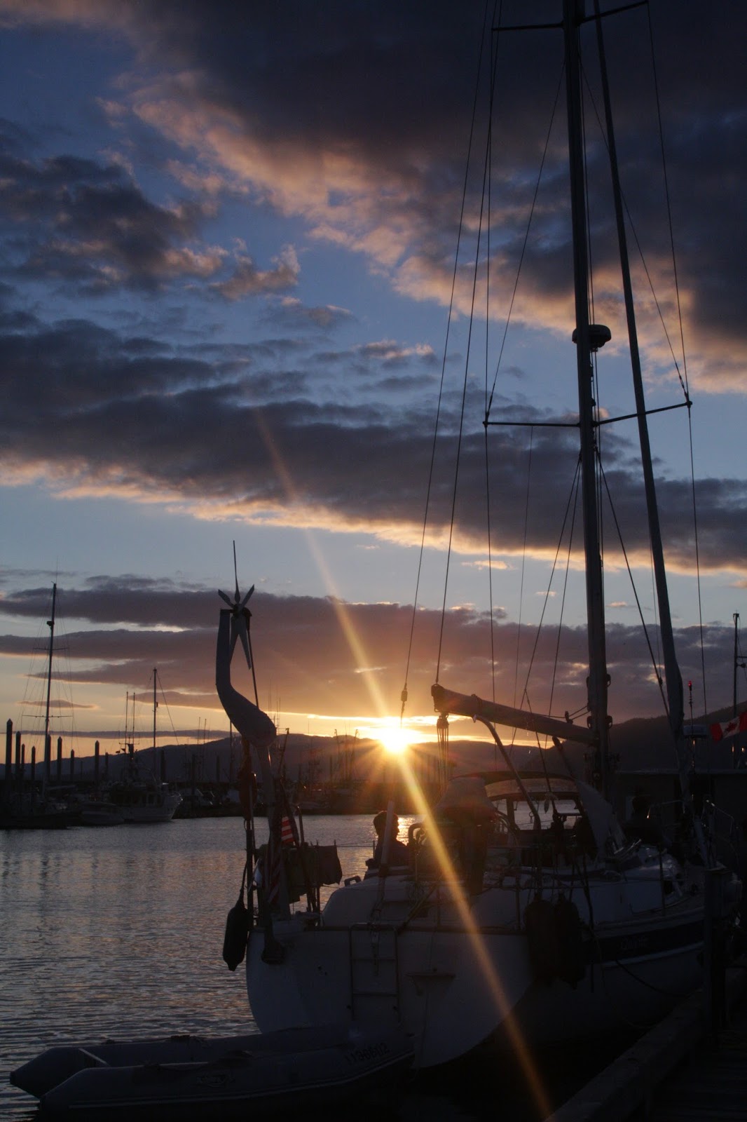
After setting the anchor in Tracy Arm Cove for the night, Frederic paddled the dinghy out to a small berg in the anchorage and chiseled some pieces off and into the cooler: fresh water!  With that and a little more water in the tanks than we thought, we think we have enough for one more night out before heading into Juneau.  Taku Harbor here we come!


Day 46 - Score! ; Rod

We secured our permit for entry into Glacier Bay today!  It was a rather tortuous process getting one. After telling us they never received our application, they eventually gave us a short notice permit and then admitted to using the information off the "application submitted in May..."  That would be the one they say they never got.  Who knows what goes on in the halls of Montezuma. Whatever the case, we have our green light.  Kay, Vi and I will be entering Glacier Bay on June 30.  That's a day ahead of our master plan with permission to stay until July 5th.  We get to spend the Fourth of July in Glacier Bay!  I suppose fireworks would be frowned upon.

Lavanya and Jason just left the boat in a flurry of hugs and handshakes; Frederic and Marta will soon be following in their wake, taking the same flight out of Juneau.  What a terrific couple of weeks it has been with them all.


Day 45 - Changing Crew; Rod

This marks the half way point - in time at least. We will be going a little farther north between here and Glacier Bay. The park has a process for entry permits that, like many trail permit systems, awards them to people who apply early, while leaving some for people who arrive without them. Leaving nothing to chance, I filled out our permit application several months ahead of time and then hit the send key to email it ten seconds after it was eligible to be submitted. Then I waited. I expected to hear at least an acknowledgement that they had received the permit, but when a couple of weeks went by without hearing anything, I sent them another email with a copy of the application and asked them if I should have heard a response. They said yes, but that they didn't get the first one and now the permits are all taken. Sigh.

Call me cynical, but I have to wonder if something is amiss at their end. Did they really not get it or did they just not want to use up a permit on a boat coming from Seattle with any number of things that could delay our arrival. We'll never know. Whatever the case, we now find ourselves having to get one on arrival and we have no idea how that's going to go.

In any case, I'm glad we saw Tracy Arm and navigated through all the ice bergs there. Talking to other boaters along the way we found out that the end of the arm is essentially frozen over. No one but steel hulled tour boats are getting much further in and very few are going as far as we did. It will be interesting to talk to the park rangers and find out what kind of a state Glacier Bay is in. With so much ice in the bays, we might find ourselves looking for an alternative itinerary, even if we can get a permit.

This is the end of the line for Marta, Frederic, Lavanya and Jason. It has been such a pleasure having them on board these last couple of weeks. We have really eaten well with their combined culinary prowess. Marta and Frederic are so outgoing, they seem to meet everyone on every boat and pass along their stories afterward. It's really a gift. Yesterday, Marta met a fisherman - a very hansom fisherman, she noted. He passed her his phone number as they parted ways. Wow! Making connections in Juneau the old fashioned way. She and Frederic had a good laugh over that.

Vi will be joining us for the last two weeks before we take a short break in Petersburg to fly home for ten days. We're looking forward to the next chapter and are already reminiscing on our time enjoyed so far. Six weeks down and six weeks to go.


Photos by Frederic

Day 44 - Barely There; Rod

Taku Harbor is a favorite anchorage for boaters from Juneau that want to get away for a weekend. It has a free public dock with walking paths to a small shelter, an old decaying cannery site, and some abandoned coast guard housing - things to explore while stretching our legs. It's late June, so I'm surprised there aren't more boats in here. We tied up to the dock for the night and talked to some of the other boaters. One couple from Juneau said this place gets crazy on a three day Memorial Day weekend. Motor-cruisers tie up three deep to a floating dock on the other side of the harbor and get drunk, discharging firearms haphazardly. Lovely. It's nice to be here with a little more sanity.

We spotted a young bear while we were under way today. It was foraging along the shoreline. This is big news only because we were becoming convinced that in spite of all the information claiming the forest is thick with them, we hadn't seen one bear since leaving Canada. Now we can happily report that Alaska has at least one bear.

We arrive in Juneau tomorrow a day early. We still have the three gallons of bottled drinking water, so we've been able to get by with what we have by washing dishes in sea water and drinking the iceberg melt that Frederic corralled, but it will be nice to get into town and fill the tanks.


Day 42 - The Best Laid Plans; Rod

We so appreciated those showers and laundry a couple of days ago, but water is running low with three days remaining until we reach Juneau. We're beginning to regret the lavish showers. But only a little.

It's hard to know how quickly six people will go through 110 gallons of water unless you learn from direct experience. I think I could have done a better job of emphasizing how limited our water resource is, but that's all water under the bridge, so to speak.

We have three gallons of bottled drinking water, a gallon or so of ice that will melt into clean water, and an unknown quantity of water in the tank with a gauge that says it has none. I'm not sure what is up with that water gauge. It works, sort of, but it doesn't reflect the linear water usage. It says full until the tank is empty and then it says empty. I'm going to have to have a look at that after I return. It's kind of important to know how much water you have before you run out.

Now we have an abbreviated cruising plan for getting us to Juneau. Instead of going across Stevens Passage on day one, up Tracy Arm on day two, up to Taku Harbor on day three, and into Juneau on day four; we will cross Stephens Passage and go up Tracy Arm on (a long) day one, then skip Taku Harbor and go into Juneau on day two. That should get us there with what little water we have left. There was some discussion and support for going all the way into Juneau tomorrow to fill the tanks and head back out, but that kind of slog doesn't appeal to everyone.

The weather may have something to say about our plans as well. The seas this morning are calm but we can see weather moving in from a distance. Winter is coming.

Day 41 - Snug for the Night; Rod

We're in Snug Harbor tonight, our last evening of blue skies for a while if the weather forecast is accurate. Rain is on the way they say. Tomorrow we make our way across Stephens Passage toward Tracy Arm Cove and we'll cruise up the arm the following day. We expect to see calving glaciers and ice bergs if all goes according to plan.

Day 40 - Best of days; Rod

Ahhh!  A shower day! Shower days are the best days (there are many best days for a variety of reasons).  Shower days are best for the obvious reason that the hair and body gets a scrub, but also because we only feel compelled to shower on warm, sunny days.  And today is gorgeous.

There's a hot water heater in the engine room that's connected to shore power in a marina or gets heated by the engine while under way.  So we get hot showers now and then on the aft deck, which involves washing hair and sudsing the bod from a bucket, rinsing off from the shower hose, and then using the remaining sudsy water to clean a few articles of clothing. We hang the wet laundry on the life lines with clothes pins, which gives Quijote a back yard look for half a day, but it's nice to have a clean start every few days.

We left Read Island Cove early this morning to take advantage of the placid sea state.  It was a perfectly spectacular morning with clouds shrouding the surrounding mountain peaks while giving us good visibility across the water.

Almost immediately after re-entering Frederick Sound we found ourselves surrounded by humpback whales blowing geysers of spray and rolling their tails out of the water.  We cut the engine and drifted, reveling in the sights and sounds of their feeding rituals.  We spotted and photographed whales throughout most of the day and opted to drift among a pod while we ate lunch late in the afternoon.

After lunch we motored over to investigate a rock loaded with seals and sea lions that we heard (and smelled) from miles away.  The seals were in full frolic in the shallows just off the rock, while the stately sea lions lorded over them from the rocks above.

We proceeded on to Cannery Cove, lush and green, surrounded by a mountain basin.  There's a small fishing lodge at the entrance to the bay that used to be a cannery.  The cannery depleted the salmon stocks and put itself out of business.  So far the bugs are behaving, the sun is shining and the shower was superb - definitely a best day.

Photos by Frederic

June 27, 2016

Day 39 - Gone Fishin' ; Rod

We wound our way through the Wrangell Narrows today. twenty miles of mostly 20-25' depth.  We found it reasonably easy to follow the navigational aids like breadcrumbs through the forest.  Several range markers along the way provided guidance through the longer stretches - we steered the boat to align markers on the far shore and stay centered in the channel.  The biggest challenge wasn't the depth (even though we entered the narrows near low tide), the width of the narrows (150' for some stretches), or the navigation (while exercising due caution); the crux was dodging skiffs full of fishermen, standing in their boats, who were focused on their fishing, and not so much where their boats were drifting as they wandered around in the middle of the channel.

There was a lot of salmon in the narrows.  We went through at the right time apparently because we saw a lot of them jumping out of the water and several being reeled in by the fishers.  Frederic made a valiant effort to land one by trolling a lure, but the salmon were unimpressed.

Exiting the narrows we slid past Petersburg checking our emails without stopping.  From there we crossed Frederic Sound and did some whale watching on our way into Read Island Cove for the night.  It's a beautiful cove, picturesque and secluded, if a bit tight.  There's barely enough room for one boat to swing.


Photos by Frederic

Lavanya and Jason have made awesome dinner meals the last couple of nights since boarding in Wrangell, arms loaded with fresh vegetables.


Day 38 - Charting the Wrangell Narrows; Rod

We're staged to transit the Wrangell Narrows tomorrow by anchoring in Deception Point Cove tonight. These narrows are twenty miles long and likely to be full of commercial traffic. The rules of the game are to follow the navigation aids and chart closely, stay out of the shallows and out of the way of other traffic. Standard navigation really, just a lot of it. We'll proceed slowly and do our best, following a course set on the plotter while Frederic follows our position on the paper chart. The plotter has an identical (up to date) rasterized version of our (out of date) paper charts. Having the paper charts along gives us the comfort of redundancy in case something goes wrong with our electronics at the worst possible moment.

The chart plotter is not infallible. It spontaneously cycles power occasionally, requiring a minute or two to reboot, probably owing to an intermittent power connector on the back. I've also notice that there are some levels of chart detail that fail to update properly and leave the screen blank until we zoom in or out a level - a problem with the purchased map data. For the most part, however, the chart plotter has worked quite well and serves to get us from one anchorage to the next without any problems. Even so, it is prudent to have a healthy distrust of the technology.

Should the plotter stop working completely we also have a full suite of charts and a redundant gps on a laptop, the paper charts, and as a last resort, a hand held gps. The handheld gps uses the least amount of power, so it's the one that is always plugged in and serves to warn us during the night if the anchor moves.

June 20, 2016

Day 37 - Photos!

Internet data transmissions are becoming painfully slow as we work our way north.  Even in major towns like Ketchikan and Wrangell where the phone works fine, it can be painful at times to update email via cellular service.  It's supposed to be 3G, but it doesn't act like it.  I got up early this morning with the laptop under my arm and headed into town to see if I could wait out at least one photo transmission.  There are so many to choose from.  We'll start with this one taken by Frederic that shows a happy crew amid the southeast Alaska scenery.

Now let's see what else we have time for...
Photos by Rod, Frederic and Marta


June 19, 2016

Day 36 - The great Bear Hunt; Rod

We went bear hunting today. With a lot of miles to make before arriving at the Anan Bear Observatory, we started from Meyers chuck at an early hour hour and made our way north under light wind, calm seas, and surrounded by islands shrouded by clouds and mist. Beautiful.

The book warned us that the Anan River Inlet was at best a temporary anchorage and that we would want to leave crew onboard to keep an eye on the boat. It also said parks dept. personel would greet us. As it turned out, the former was true, the latter was not.

Incredibly, we arrived to find no one at the anchorage. Unfortunately the inlet was loaded with crab pots, making a difficult anchorage nearly impossible. Once on shore we found an empty parks dept shelter with a guest register. We marveled that the last entry in the register was in May and resolved to change that. Regrettably the pen was dry - mystery solved.

The info board at the trailhead noted that the season for collecting fees to access the observatory starts July 5th. Feeling a little smug that we would be able to enjoy seeing the bears without paying, we started up the trail. Along the way we found ample evidence of bears: lots of fresh scat, over turned rocks, and bear tracks.

A mile or so in we came upon the vacant observatory, a large deck structure overlooking the rapids of the Anan River. One can imagine observing salmon swimming up stream, bears feeding freely, and tourists watching from above. Unfortunately the day we were there, there were no fish, no bears and no tourists. We were feeling a little disgruntled about the absence of bears, but it was a beautiful hike.

We returned to the boat and headed north again toward what promised to be a secluded anchorage, only to find that it too was full of crab pots. There must have been fifty crab pots in that anchorage. That we were able to shoehorn between several of them is less a testament to our skill than the crabbers shabby job of packing the bay with as many pots as possible.

Day 35 - Muscle Beach; Rod

Today's sail from Ketchikan to Meyers Chuck was nothing short of a romp: sunshine and wind blowing from behind at 15-25 kts. It doesn't get much better. Frederic and Jake were dying to catch a king salmon, but trolling speeds were tough. It's hard to get Quijote to slow down.

Meyers Chuck is the kind of a place that makes you wonder what keeps it going. It's a lovely little community on a cove with a population of twenty full time residents, a US post office, a public dock and a trail to the edge of town. We arrived, dropped our anchor at a suitable distance from the float plane dock, and settled in to relax.

Half an hour later, a friendly gentleman motored his skiff over to tell us that the bottom of the bay can be foul in places. He's had to help at least one boater out whose chain got wrapped up in all the garbage at the bottom. But we're already anchored and it will either come up cleanly or it won't. Why fret about problems today when you can put them off until tomorrow?

Jake did another amazing job of making dinner tonight. His skill in the galley is nothing short of phenomenal. He and Frederic harvested some muscles off the beach this afternoon in their explorations, then brought them back to the boat, cleaned and cooked them up in a garlic cream sauce And served them up for dinner. Heavenly!

Meanwhile Frederic opted to plank a salmon filet on the BBQ. Unfortunately he shortcut the soaking process and ended up with a four alarm fire in the BBQ. The salmon was saved, but not the plank. Sorry Bob!

Tomorrow promises to be a long day as we intend to stop by the Anan Bear Observatory on the way and we have a lot of miles to put in, so we'll get an early start and probably arrive at Berg Bay late in the afternoon, From there it's only a fifteen mile day into Wrangell.

Day 33 - Ketchikan on Foot; Rod

Ketchikan has come and gone, sandwiched between two glorious days of downwind sailing.

The town of Ketchikan has multiple personalities. On the one hand a cruise ship hub and on the other a working port for fishing and lumber. Constant floatplane traffic is coming and going. Alaskans appear to take floatplane travel for granted, like people in suburbs do their SUV's.

After running downwind for most of the day, we called the Ketchikan harbormaster on arrival and secured a slip assignment for two nights at Bar Harbor. The harbor rents out the slips of fishing boats that are out of port.

All the town was essentially within walking distance of the boat - and most importantly, showers, Safeway and laundromat.

Marta and Frederic treated the crew to a terrific seafood dinner at a nicer restaurant. The king salmon was incredible, the kind of salmon that melts in your mouth.

The following day it was time to get some exercise. Before leaving Seattle, I printed out route descriptions of various hikes along the way, including one for Ketchikan called the Deer Mountain Trail. It turned out to be an hour hike to get to the hike and even with a description it wasn't easy to find. At one point a woman called to me from a car: "Are you going to the dump?" I was clearly not dressed for a trip to the dump, wearing my sun hat and pack. She pointed me in the right direction, and I was relayed to another woman in her pajamas talking on her cell phone who finished the job of getting me there. The town is obviously used to corralling stray hikers.

The trail itself was remarkably similar to trails on the Olympic Peninsula: misty and wild with lots of skunk cabbage and moss covered trees. As I climbed up and up, I caught a brief glimpse of the town below, its cruise ships, marinas and floatplanes, before walking up into the clouds. Trees and shrubs quickly became sodden and the air, laden with moisture. The birds were overjoyed. I pressed on up, going four miles or so before turning around. It was a lovely hike.

Day #32 - A spot of Sunshine; Rod

The passage from Prince Rupert across the Dixon Entrance into Southeast Alaska is the second of two larger water body crossings on the way north that have exposure to ocean weather and swell. (The first was Queen Charlotte Sound). We were able to put the Dixon Entrance behind us yesterday in better than forecasted weather.

The day started with a dawn departure from Prince Rupert and careful navigation of the narrow, winding, shallow Venn Passage. With Frederic keeping an eye on the paper chart (and on my steering) and Jake on bow watch looking for floating debris, we made our way through without incident. Along the way, we were often jostled by fishing boats roaring past us on their way to a day's work.

Once out in Chatham Sound, the weather cleared as the day wore on and the seas were mild in the lee of Dundas Island were most of the fishing boats had charged off to. Out in Dixon Entrance we saw one or foot chop layered on a long, rolling ocean swell of about 2-3 meters with occasional larger swells. The chop and the swell diminished as the day wore on and we inserted ourselves deeper into Revillagigedo Channel toward Foggy Bay.

I'd called the US Customs office the day before and let them know we'd be anchored in US territory for the night before clearing customs in Ketchikan the following day.

The Bay itself is reasonably well protected and has some shoreline that, while not tropical by any means, was large and dry enough to get off the boat and run off our ya-ya's.

Marta constructed an elaborate rock sculpture in the vein of Adam Goldsworthy. Emily and Jake orchestrated crab fighting in a miniature walled off arena. (For the record: the crabs don't fight - the big crabs just sit on the smaller ones, making them top dogs, so to speak.) Kay and I played desultory frisbee (running on that rocky terrain is difficult.) And Frederic documented the proceedings for posterity with his video gadgetry (think: go-pro on a telescoping selfie stick).

There was only one other boat in the bay with us and plenty of room to swing. That was fortunate, because after a terrific taco dinner cooked up by Jake and a better than average sunset, the wind and rain kicked up during the night and continues to push the boat on her anchor this morning.

The wind has clocked around from NW to SE as was forecasted, so conditions out in the channel are likely to be sporty as we make our way toward Ketchikan today. Given that, we're in no hurry to get going. Is that a spot of sunshine I see?

Sculpture by Marta, Photo by Jake

June 17, 2016

Day 34 - Sancho Says... ; Kay

Well!  Sancho Panza here, coming to you after several days of silence on the SV Quijote blog.  Life on Quijote is unbelievably busy!  After Bob departed in Shearwater, BC a whole week went by with few conversations between Rod and Kay.  They appeared to have a good time, it was just a bit quiet after Bob's hilarious dry humor and thoughtful probing questions which kept everyone engaged with each other.  Rod and Kay kept busy with more solitary activities such as reading and writing.

In Prince Rupert, BC the De Wulf family of 4 joined us which ramped up the inter-personal activity. They are active with sailing, conversing, playing of cards, and listening to music, still leaving plenty of time to rest and read.  Most notable are amazing dinner meals during which there is much activity resulting in delectable gourmet delights thanks to the efforts of Jake, and supporting assistance.

Today we are anchored in a lovely little bay known as Meyer's Chuck.  Maybe it is Chinook jargon for a body of water.  And the Meyers settled here many years ago.  There are a handful of homes dotted around the rocky, treed shoreline.  Most appear to be summer homes. We dinghied to the dock and walked The Path which is the path past the various permanent residences and summer-time homes.  No road. No sidewalk. Just a dirt path through lush forest of ferns and salal and trees to the various dwellings.
Kay took me for an evening dinghy row around the bay.  She rowed up to boats docked at the public float and chatted with various other travelers. Always an interesting collection of folks from which to gleen information.  They love to share their stories and are always interested in our travels as well.

Sailing days have been rather sporty with swells and wind waves causing conditions which can be trying on one's enjoyment of the ride. Kay however appears to enjoy the rollicking waters with glee.  Baking muffins down below while I, Sancho Panza, assist her in holding on to items which would otherwise fly across the galley when Quijote rolls back and forth with the swell. She appears to genuinely enjoy the excitement, spontaneously emitting whoops and yahoos to express enthusiasm.

Each day we look forward to adventure.  Sometimes it is a remote, yet developed area such as Meyer's Chuck. Sometimes it is a remote and lonely anchorage, such as Patterson Inlet.  Sometimes it is a noisy, smelly town where fueling, water replenishing, and stocking up on fresh food occurs. It is always a good sail and a good day.
And every night is a good sleep. Which is where we are all headed now, to bed.

This is Sancho Panza, Out.


June 13, 2016

Day 30 - Faucet Fun; Rod

We're in Prince Rupert for two nights and it has turned out to be a relaxing and enjoyable stay. I've been impressed with the town and its people. They're friendly and take obvious pride in their public places. My primary goal aside from filling tanks and meeting up with the De Wulfs, was to fix that galley faucet.

It took several hikes to the hardware store (did I say I wanted exercise?), but it's finally done. At one point Frederic and I must have had every employee in the hardware store in a turmoil opening boxes and hunting for tools and fittings.

The first one we tried hit the cabinet above it. The second had the wrong base and seemed to be missing pieces, but the third time was the charm. Even with the right faucet, the hole in the counter was too narrow and had to be enlarged. Frederic and I scratched our heads over that for a while before finally buying a large wood bit and plugging the old hole with a wooden plug to allow us to drill out the new hole.

In the end, with the solution and the right parts in hand, the installation went quickly. And for all that effort we get a nicer faucet and new valves under the sink so the water can be turned off. We can finally relax and do something else in town beside traipsing back and forth to the hardware store. Frederic is celebrating a job well done by rattling the floorboards. At least I hope that's not someone taking a chainsaw to the aft cabin.

June 11, 2016

Day 28 - Hikers Remorse ; Rod

The one thing I wish I could change about this game is the lack of exercise. I knew going in that not being able to hike much or play tennis or even go for long walks was going to be (I hoped) the primary difficulty. I've been dreaming of doing this trip for most of my adult life, so having the opportunity to actually make it happen, I figured I would just have to suck it up and enjoy/endure something sedentary for a change.

So here I sit, tucked into a majestic bay on Banks Island. We're far removed from civilization. There are steep, wooded, virgin slopes, flowing down from the mountain tops to the waterline, with rocky, kelp-slick muddy shores. The sky is blue and the weather is perfect.

And there's not a trail, or even a place to walk for miles. So I sit, read, workout, write a bit, enjoy my surroundings, and think what might be done differently next time.

I can start earlier (than mid-May), or go later than the end of August so there is time to fly home more often - or fly somewhere else, do something else.

Go for shorter trips. Having knocked this off my bucket list, I can move on to other things: a circumnavigation of Vancouver Island will take half the time and leave plenty for other things, more exercise.

Also trips south will be less environmentally challenging - more trails, friendlier beaches, warmer water, feasible swimming. I've been surprised by how few people there are out here doing this trip. We go for days without seeing another recreational vessel. Maybe I shouldn't be. As much as I'm enjoying it, full time cruising in on the BC coast and SE Alaska is not for the athletically inclined.

I'm ok with that. We don't have to like everything about the things that motivate us. We can learn from our experiences and let them guide us toward the things we do in turn. As for this trip at this time, I wouldn't change a thing. Fewer trails mean fewer people and that's part of the appeal of this area, even if I do need a good workout. We're in Prince Rupert tomorrow so I think I'll get one.

Day 27 - A Good Start; Rod

The trip so far is everything we might have hoped for.

Expecting a day of rain in every three (according to statistics I read), we've seen more like one in five, and half of those were hardly more than a brief sprinkle. Granted the weather can be rather foul even without much rain, but in four weeks of sailing north from mid-May to mid-Jun, we've seen four or five days that counted as real rain and only a couple of those needed foul weather gear by virtue of coinciding with time under way.

Not much has gone wrong mechanically either. We have a lot of tools and spare parts squirreled away for dealing with inevitable problems, but so far - knock on wood - Quijote has been humming along like the well oiled machine that she is. I feel like the Maytag repairman, jumping at the opportunity to replace a button on the upholstery that comes loose. The galley faucet has started dripping, but spare faucet seals are one item I didn't think to pack along, so that repair will have to wait until we arrive in Prince Rupert in two days.

And we can't complain about our health. We have so far remained illness and accident free. Even the bugs have been mostly friendly.

Granted it is a bit early in the game to crow too loudly about our good fortune, but as trips go, this has been a very good start.

Day 26 - Eagle Eye to Eye; Rod

We're in the eagles lair tonight. They let us know it too. Patterson Inlet is long and deep with two beautiful, remote, otherworldly pockets carved out at the end. Knowing we would find easier anchoring in the north bay, we did a drive-by of the south to have a look. On our way in an eagle cruised by - checking us out checking him out. An adult male bald eagle in flight over the boat with cliffs in the backdrop, was nothing short of majestic.

Later, settled into the north bay, we found three bald eagles in the tree tops around us. It wasn't clear if they were telling us off or each other, but they were certainly vocal.

Poor eyesight and worse memory for that kind of thing make my qualities as a birder somewhat dubious, but Kay is quite good at it. She's been constantly spotting and identifying species. She generally spots them with naked eye, verifies her find with binoculars, and points them out. Then with binoculars I can usually find them. I don't think I've spotted anything she hasn't already seen. That's ok. It's great being in company with such an ardent wildlife enthusiast. It's like visiting rome with an historian, or Madrid with a bullfighting fan.

I have to wonder if eagles get the same kind of thrill seeing us entering their domain as we get seeing them. I'm guessing no.

Day 25 - The Music of Quijote; Rod

We have a windy anchorage in Monckton Inlet today. The wind generator is humming, at times wailing. As the boat wanders around in the anchorage in response to various gusts and lulls, the anchor chain is dragged across the bottom of the bay in one direction and then back in the other, growling in protest all the while. The dinghy and the hull play two part harmony, slapping in time to the rhythm of the waves. The US flag, mounted on a wooden pole fixed to the stern and a smaller Canadian flag on a flag halyard that runs to the mast spreader are flapping wildly, each vowing to outdo the other. Each anchorage plays its own symphony, displays its own personality.

This bay has ample swinging room for many boats, but today, it's just us and a fishing trawler, also with a US flag. We're both a long way from home. The couple in the trawler waved as we entered the bay, appeared happy to see company; isolation to share.

Wildlife is scarce tonight, but a seal pokes it's nose out of the water to have a look at us. Kay has gone below for a nap and soon another sound is added to the mix. The seal dives out of sight.

The wind and chop make dinghy exploring less appealing, so with chores done it's time to relax and do some reading to the music of Quijote on Monckton Inlet.

Day 24 - Making for the Outside Passage; Rod

We have an embarrassment of riches when it comes to passage planning at this point. We find ourselves three days ahead of schedule, with four nights to squander before we meet with Frederic, Marta, Emily and Jake on Sunday, June 12 in Prince Rupert. Kay and I sat down this evening and put our heads in the books and charts to decide where to explore.

Before we leave Curlew Bay, we have a decision to make: Inside Passage up Grenville Channel, or Outside Passage up Principe Channel. Grenville Channel is a marine highway up to Prince Rupert with fewer options for exploring along the way. Principe Channel is wild with abundant opportunities to explore a plethora of small bays and coves between Banks and Pitt Islands.

With plenty of time on our hands, the question comes down to weather, since the outer passage is more exposed to wind and seas along the way. We woke this morning to find the forecast fairly settled with winds expected to be less than 20 knots in Hecate Straight for the next several day days; winds in Principe Channel ought to be lower than that and the anchorages are well protected, so we're thinking we will go the more interesting route and see what happens.

Now on the itinerary are Mockton Inlet (according to Douglass: "This is true Outer Passage Wilderness"), Patterson Inlet ("…particularly beautiful"), Colby Bay (our only visit to Banks Island), and Newcombe Harbor. From Newcomb we are on to Prince Rupert for a couple of nights where these latest posts can be posted.

Day 23 - The Straight and Narrow; Rod

Today turned out to be much better than we expected. Strong winds were forecasted out in Queen Charlotte Sound with 2-3 meter swells rolling in off the ocean. I pictured wind and waves funneling up into the Laredo Sound, where we would be after our transit of the Meyers Passage.

We started late to let the water level rise in the narrows and to let the current moderate. The trip down into the Meyers Passage turned out to be the toughest part of the day. A light rain and mist moved in with fog and reduced the visibility to less than a mile. What drove us nuts though, wasn't the weather, but the flotsam. Long eddy lines of junk in the water (logs, stumps, branches, boards, sticks, and plenty of seaweed) blocked our way off and on all day. We posted Kay on the bow to keep a sharp eye out for the less obvious hazards and agreed on hand signals to guide us through it all.

The signals are designed to be clearly visible to the helm. A straight arm out means start a slow turn in this direction to avoid and obstacle ahead. Bending and straightening the arm to make a pointing motion ads urgency for a quicker turn. Both hands out means slow down. Both hands out raised high above the head means full stop. Our signaling is a work in progress. The first iterations were difficult to see at the helm and difficult to interpret, but we're getting better

We hit the narrows right about when we wanted to and the passage proceeded smartly. We found about 18' in the narrows at 3/4 tide, that's a little less than twelve feet under the keel: plenty of room.

Poking our noses out into the sound we were delighted to find mild conditions. It turned out to be a lovely afternoon and evening in spite of the forecast.

There were two wildlife viewing highlights for the day. A pod of a dozen or so porpoises escorted the boat for a while. Then after the narrows, a whale put on a show for us, taking full body leaps out of the water (breaching). It seemed as though it was trying to make the largest splash posssible. It blew fountains of mist into the air and then launched itself up out of the water again and again, like it thought we were National Geographic photographers. It will be sorely disappointed when the next issue comes out.

With the going good, we made a long day of it today and anchored in Smithers Island Cove, rather than Hague Point Lagoon (for those back home who are keeping score). The setting is beautiful, but the anchor holding can be difficult because the bottom is rocky. Thankfully our oversized anchor set easily and we spent another lovely evening with our transom fifty feet off the shoreline. Nice.

Day 22 - Making Friends in Mary Cove; Rod

It's Sunday evening on Quijote; we're anchored next to a babbling brook - several of them in fact. Water is coursing down the Roderick Island hillsides around us and while we can't see the streaming through the dense thicket of cedars, the gurgling has been a constant companion since our arrival this afternoon.

We have other companions keeping us company tonight as well: while paddling the dinghy around the cove before dinner, we spied a sea otter swimming full speed astern on his back. We thought we might be able to sneak in ahead of him by scooting the dinghy silently into his path and letting him pass us unaware of our existence. Unfortunately that took us closer to the mouth of the cove were the waves were a little more energetic and the dinghy started slapping a warning - enough to rouse the otter's awareness. He stretched his neck to elevate his eyes as far as he could get them, then stared at us for a long moment. You could just see him thinking: "what the…" If life was a cartoon this is where his eyes would bug out as he suddenly realized we did not belong in his cove. As it was, he rolled into the depths with a flourish, and was gone.

An hour later, back on board the boat, Kay noticed something moving on shore fairly close. Training our binoculars on the creature, we couldn't decide what it was, even with a good, long look. I was convinced at first that it was a harbor seal, but while it's head, snout and body looked like a seal, it crawled around on the rocks on all fours, then swam in the water with the ease of a seal. We took to calling it a sea weasel, but without books or internet we still don't know what it was.

It was a good day for wildlife viewing on the way over here as well. We had a nice, long look at a pod of humpback whales rolling about, lifting their tails, spouting and frolicking. Then on a couple of occasions we were escorted by a pair of Dall's porpoise racing along side the boat as though daring us to ramp it up a notch. They raced in front and peeled away again and again. It's common behavior for them, but always a thrill to see.

We have a late departure planned for tomorrow, so maybe we'll see our new friends again in the morning. We want to make sure the depth in Meyer's Passage isn't too low when we go through. Then we're on to Larado Channel and a few more nights into Prince Rupert.

June 8, 2016

Day 22 - Shearwater stopover; Bob

Hiking to Edge Lake


We stopped at the coastal town of Shearwater after a glorious run up Gunboat Passage.  This area has a sub-alpine quality to it with smaller trees.  At times Gunboat passage looked just like a long gorgeous mountain lake.

This is sport-fishing country apparently.  At the dock in Shearwater there were several professional charter boats ready for customers and happy to charge from 6-1200 dollars per day for the privilege of getting a salmon or two.  I think the season was in a lull for I did not see any actual salmon that had been caught.

This was where I was dropped off to head back to Seattle.  I needed to get back to attend my daughter's High School graduation!  We had a great dinner and took advantage of the "Loonie Showers" the night before I parted ways with the rest of the crew.   They are sailing on and I miss them!  Others will join them soon.

It was sad to leave and I had most of day to "kill" as I waited for a flight at the nearby town of Bella Bella.  What to do?  I decided to go on a hike.  It was quite hot and the trail I saw on a little brochure was difficult to find.  I got the impression that few people ever actually walk on this trail - perhaps because of bear danger?  I was alone and the trail was very wet in the low spots.  After gamely crossing about 30 of these very dark pools of bog water the bugs were starting to wake up and I did not want to get my feet wet so I headed back to town.  I only walked maybe 4 miles but it was hot enough to make me start to sweat.

Next I kicked around Shearwater, doing a bit of exploring.  This was an old RCAF base where seaplanes were based for a time.  Many rather large hangers and buildings date from that era in WWII.  I came across an old bunker where the airmen would take cover if the Japanese attacked.  It has a "company town" feeling and there is a bit of poverty evident.  One treat: I saw a deer swimming across the channel....

First Nations canoe


Next I took a water taxi to the nearby town of Bella Bella in British Columbia.  This is a First Nations town and it was really interesting.  I had several great conversations with people, all very very friendly.  At the airport there was some excitement.  Just as we were about to board our flight out, another private came in for a hard landing and damaged the runway.  We could not take off for about an hour and there was much rushing about as the wrecked plane was removed.  Apparently this is the only crash in the last 15 years there!

Queenie


Then I took a scenic flight to Port Hardy, flying over the very area we had just sailed up (Fitz Hugh passage).  After a stop there, we flew for another hour to Vancouver and I re-entered civilization!  The trip over the northern part of Vancouver Island was really special.  I could see just how far we had sailed and saw more boats making their way North...

June 4, 2016

Day 21 - Weather works; Rod

We've been sailing and motoring our way up Fitzhugh Sound for the last three days, anchoring in small coves along the way. The weather has been somewhat grim the whole time: rain, drizzle, blustery winds, choppy seas; rewind, replay.

At night we turn the radio on and listen to the weather forecast. for that night, the following day and for several days after that. Listening to the reports requires patience and a proficiency that takes some time to build. Most of the report is not useful. The thing that makes the listening and the comprehension difficult is that they give a report that covers so much ground. And the report is organized by topic and not by region.

First there is a synopsis that describes frontal movements, then a report that goes region by region along the coast of northern Canada and gives for each, a forecast for the night and the following day. Then you have to wait through a long list of sea state forecasts, buoy reports, lighthouse reports, and finally an extended three day forecast for the same regions covered earlier.

The region we are in at the moment is called "Central Coast: McInnes Island to Pine Island." To get a report for tonight, tomorrow, and the next three days, You have to sit and listen for a long time and snatch what you need from different places in the report. If you get distracted by someone talking to you at the wrong time, or have difficulty listening and writing at the same time, You'll have to listen for quite a while to hear it again in the next loop.

One thing that helps is to time the stages of the report. Tonight, for example, it took six minutes between the next day forecast and the extended forecast for a given region, and the entire loop took 16 minutes. Knowing this gives me the option to do something else while waiting for what we want to know.

It has also been suggested that we can record the parts of interest to make it easier to re-listen.

There are ways to receive this information as a text file by satellite, but when I looked into the technology, I found it to be expensive for the equipment, expensive for the service, and likely to be ineffective at getting reception in a small cove.

So we listen. And listen, and listen. And it gives us a sense of what to expect out there. Sort of.

Day 20 - The Fury Cove Boat Show; Rod

The last couple of nights we've enjoyed anchorages to ourselves; blessed seclusion. Tonight we're stacked into Fury Cove like cordwood with eight other boats. This is a very popular place. It didn't start out that way. We were the first ones here at 10:30 this morning and we set our anchor well with ample rode. At that time we entertained the delusion that maybe we'd be lucky enough to have the cove to ourselves for the two nights that we planned to stay.

Then the boats started arriving, one by one all afternoon and into the evening - each seeming to use less rode than the last, until the most recent arrivals which appeared to rest their anchors on the bottom under their boats

While the other boats were fighting for space, we deployed the inflatable kayak for the first time, then paddled the dinghy and the kayak to the beach to explore the tidal pools, hike around a bit, and play some frisbee. We can report that the kayak does not handle well if you put the seats in backward; it puts the rudder at the front and serves to spin the boat in circles when you try to paddle forward. Doh!

Fury Cove has a beautiful setting. It's a small cove protected from the wind and waves of the sound outside, by a ring of small islands with drying shoals between them that offer a view of the action outside. We wouldn't have missed it, even with the crowd around us.

Day 19 - Learning the Caution in Cape Caution; Rod

We got lucky rounding Cape Caution yesterday. After a long few days of high pressure, the swells off the Pacific Ocean had dampened to ripples under a light breeze. This wasn't entirely luck, as we had proceeded with a little more haste than planned in order to put ourselves in exactly that position. Still, it was lucky to have the opportunity to make our break under those conditions. We were poking our noses out into the Pacific Ocean and it felt like a day on Greenlake - only bigger.

The planning had given us short hops to get around the cape in case conditions were rough, but we made the decision to blow by our intended target for that night and get around the cape while the getting was good. In retrospect, it would probably have been prudent to go even further than we did. What's another three hours after we've already done ten?

As it was we did one long day from Claydon Bay in the Broughtons, around Cape Caution, and into Fly Basin - then did the next three hours this morning. While we rested, the winds built up and got the Pacific Ocean rolling. Heading out into it to push ourselves into Fitzhugh Sound, the winds were moderate. The one foot chop and 3' swell was also tolerable while we were heading into it, but as soon as we were forced to turn north, we got rolled around uncomfortably by quartering seas that would have made it difficult to keep our breakfast down if we had had to endure it for much longer than the hour or two that we did.

Having a tase of it, we can see how difficult a rounding of Cape Caution could be. Ten hours of what we experienced this morning would have been miserable. The boat would have handled it just fine, but it would have been pretty tough on us. Add to that higher wind velocities, larger chop, bigger swells and it is clear that the rounding of Cape Caution is a passage whose name and reputation are well deserved.

June 2, 2016

Day 19- Flying objects; Kay

Every day there is a lesson to be learned.  Today's lesson: Always be prepared.

After listening to the weather report on the VHF radio, after viewing Fitz Hugh Sound from the calm of our anchorage in Fury Cove, after securing the dinghy, and items in our berths, the salon, and the galley, donning our foul-weather gear, we pulled anchor and headed out to begin passage from south to north, up Fitz Hugh Sound.

The south end of Fitz Hugh Sound is open to Queen Charlotte Sound and subsequently open to the Pacific Ocean.  We just needed to get out of our anchorage, get out into Fitz Hugh Sound a bit and take a right hand turn.  Get the wind on our stern, and head north.   

Sounds easy.  It was intense…..


The galley had been cleaned up and put away quite well. The navigation station had appeared tidy and organized.  The 'head' seemed fine.

However, as things got rough on deck a peek below showed utter chaos from flying objects in the cabin.  Books littered the floor and the 'head' was wet from open hatches. Stepping into the swaying melee, I watched as items seemingly secure behind the sink slide from one side of the counter, then back again before toppling into the sink.  The coup de tat was the cutting board flying out of it's slot across the salon! 


Day 19 - Anchor crew technical note; Bob

Anchoring when we arrive in a bay for the night and pulling up the anchor when we are ready to leave the following morning are things we do every day.  They are part of the routine of life aboard Quijote.  If you are planning to be part of our crew this summer, this blog post will give you an idea of the anchoring procedures.

To lower the anchor we start by activating the windlass circuit breakers.  Then one person stands by at the bow and waits for Rod to give the signal to lower away.  Remove the anchor tie and lower the anchor with the deck switch and call out the depths as the markers on the chain go by twenty feet at a time.  When the right amount of chain is out, Rod will yell stop.  He will then set the chain and may ask for more chain as conditions dictate.  The crew at the bow can assist in this by laying a hand on the chain near the windlass and feeling for vibrations that indicate the chain is dragging.  In the absence of dragging, the chain will grow taught and will not vibrate.  The crew can then agree that the anchor has set and the engine will be shut down.  At that point, a snubber is added to the chain that takes the stress off the windlass and adds a little stretch to the system, which is easier on the chain and the boat.

To raise the anchor in the morning we start by digging the yellow deck hose out of the cockpit locker.  The hose is connected to the deck-wash connector on the deck and the deck-wash circuit breaker is turned on that will pump sea water though the hose.  We use the deck wash hose to clean mud off the chain and anchor as it comes up.  The engine needs to be running to raise the anchor, so Rod will start the engine.  With the engine running, the bow person will start by raising enough anchor to allow the snubber to be removed.  After removing and coiling the snubber, the bow person and Rod will make eye contact and give each other a thumbs up to indicate both are ready to raise the anchor.  The bow person will then raise the anchor by engaging the deck switch as seen in the image  above.  Depending on how the chain was laid onto the sea bed or how it has moved during the night, bringing up chain can move the boat around.  If the windlass starts to labor audibly, the bow person should stop raising and let the boat position catch up with the chain.  Pointing at the direction of the chain can help as well, since it will allow Rod to use the engine to help with moving the boat.  As chain comes up muddy, the bowman hoses it with the deck was hose, so it comes on board clean.  The person also calls out the depth as the markers come up, so Rod will know when the anchor has been lifted off the bottom.  Also call out when the anchor is in sight. The bow person allows the anchor to hang from the bow roller and washes it with the deck-wash hose.   When the chain and anchor are clean of mud, the anchor can be lifted into place on the bow roller.  This sometimes manual effort if the anchor wants to come up backward.  After the anchor is in place, the line to secure the anchor is tied and the tension on the chain is removed with the deck switch.